
https://www.youtube.com/watch?v=bxHlTCnHjNo
Insight for Projects of Every Size
Our drone services are designed to support active construction projects by providing fast, visual site documentation and current site visibility.
We work with contractors, project managers, and owners who need accurate information for coordination, progress tracking, quantity verification, and reporting — without disrupting crews or adding another consultant to manage.
Drone aerial imagry capture can be deployed as a standalone site snapshot or integrated into ongoing construction site support, depending on project needs.
Our Drone Service Advantage
✅ Certified & Insured Operators
Our drone pilots are fully certified and insured, operating in compliance with Transport Canada regulations.
✅ High-Resolution Imagery
We capture crisp, detailed images and video to support everything from marketing to mapping and inspections. either in the air on from the ground
✅ Accurate Data & 3D Mapping
Generate precise measurements, contour lines, and 3D models to improve planning, design, and reporting.
✅ Fast Turnaround Times
Need results quickly? We offer efficient delivery of processed data and media to keep your project moving forward.
✅ Customized Solutions
From construction progress tracking to residential real estate shoots, we tailor our approach to fit your project’s needs.
✅ Safe & Non-Disruptive Operations
Aerial work means less downtime, minimal site disruption, and safer inspections—especially in hard-to-reach or hazardous areas.

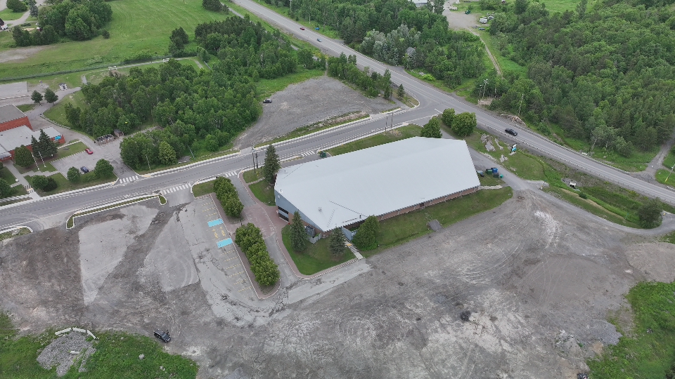
Survey-Supported Drone Capabilities for Construction Projects
-
-
Survey-supported topographic mapping (non-legal)
-
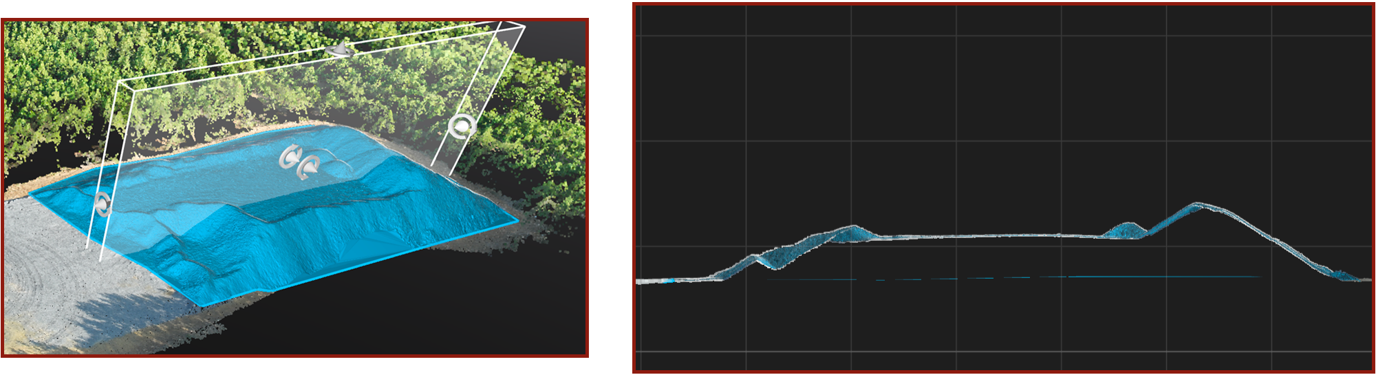
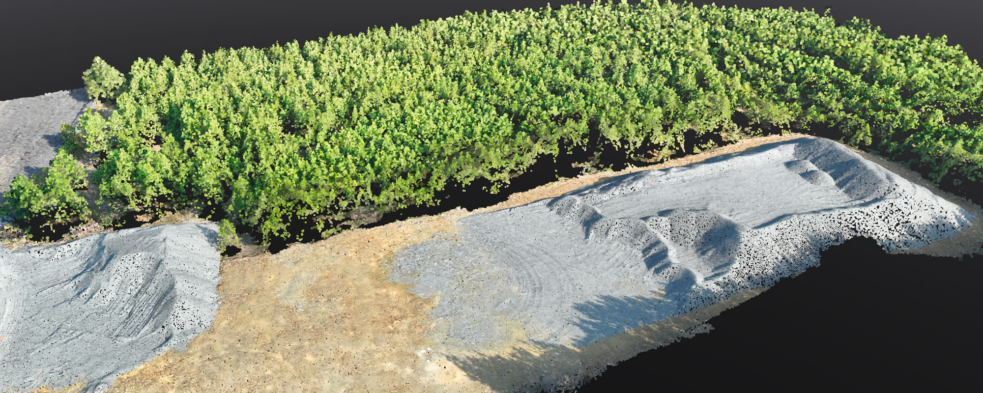
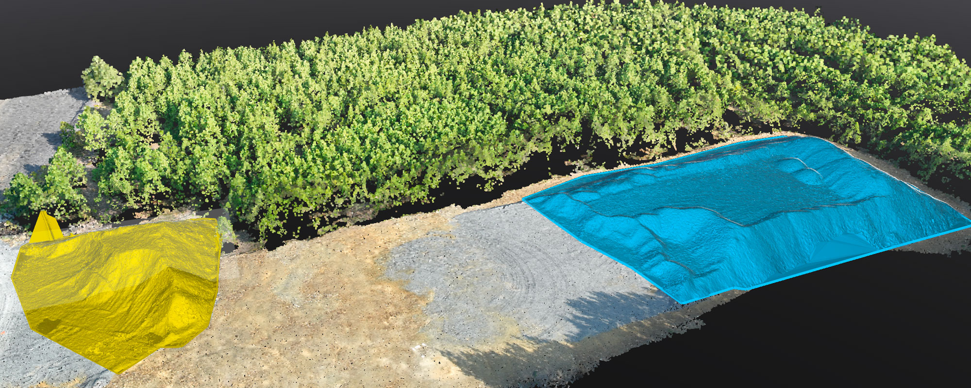
Quantity, volume, and stockpile verification
-
3D mapping and photogrammetry for construction sites
-
Construction progress monitoring and documentation
-
Pre-construction planning and design support
-
Asset and infrastructure inspections
-
Real estate and site photography for documentation
-
Visual records for coordination, reporting, and claims support
-
Precision Mapping & Volume Analysis
Transform aerial imagery into actionable data. Our advanced photogrammetry services deliver highly accurate stockpile volume calculations, contour mapping, orthomosaics, measurable site models, and accurate pre-construction and as-built surveys—all through 4D software integration. Track project progress, verify material quantities, and make informed decisions with confidence and clarity.
Ready to elevate your next project?
Let’s talk about how our drone services can support your goals—on time, on budget, and from above.